Austria

The Danube is a major economic, geographical and cultural force in Austria. Draining over 96% of the country’s territory, the basin is home to 7.7 million people. In a country dominated by the Alps, the flat lands provided by the rivers are vital for the agricultural sector, human settlements and infrastructure. The Austrian territory accounts for 10% of the total area of the Danube Basin.
Austria’s Landscape, Climate and Water Flow
Austria is a mountainous state with the majority of its relief formed by the Alps: approx. 62% of the land area comprises mountainous terrain; the remainder is hilly, with low-lying plains to the East. Alpine geological formations run in a predominantly west-east direction, with water draining northwards to the Danube and south to the Drava/Drau and Mura/Mur. The gradient of the Austrian section of the Danube is approximately 0.4 ‰, being much steeper than in Lower Bavaria (c. 0.2 ‰) and along the Hungarian Plain (c. 0.06 ‰). The larger tributaries joining the Danube in Austria directly are Inn, Enns and Morava/March.
The climate in Austria is continental, with minimum temperatures in January and maximal values in July.
Natural highlights
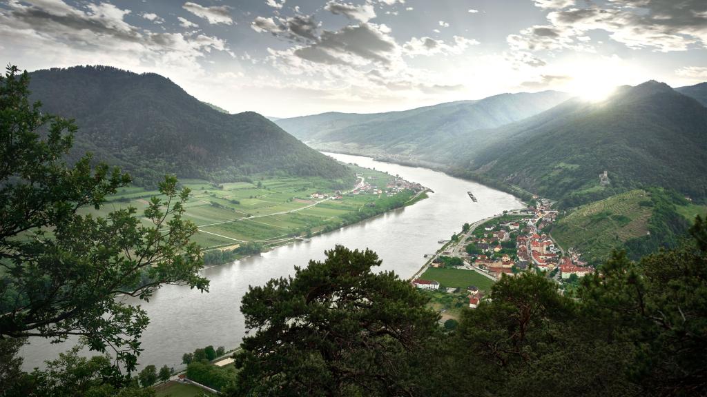
- The Wachau Valley, a stretch of Danube between Melk and Krems, is an outstanding example of a fluvial and cultural landscape bordered by mountains. Much of its evolution since prehistoric times is preserved in the landscape, architecture, urban design and agricultural use (principally vine cultivation). As a result, UNESCO honoured the Wachau with World Heritage Site status in 2000;
- The Donau-Auen National Park is a green ribbon linking Vienna and Bratislava, providing protection to a large floodplain area of the Danube. It is still ecologically intact to a high degree displaying characteristics of a large Alpine stream. The National Park covers an area of 9,300 hectares and represents a complex ecosystem with an enormous diversity of habitats, plants and animals;
- The Thayatal National Park is an impressive protected area on the River Thaya/Dyje on the Austrian - Czech border. Its characteristic meandering breakthrough valley landscape is home to diverse habitats (meadows, forests, dry grassland and rocky areas) plus numerous rare animals and plants;
- Neusiedler See (Fertő-tó in Hungarian), a large shallow lake in the border region between Austria and Hungary, is the only steppe lake in Central Europe. It extends over 315km², with more than half dominated by reeds. Situated at 115.75 m above sea level (on average), its deepest point is 1.8m and it is characterised by a high salt concentration (more than 2,000mg/l). Rainfall and aridity cause significant variations in the lake's water level. In the past, the lake has completely disappeared several times, most recently in the second half of the 19th century. [MOU3] The cross-border Neusiedler See - Seewinkel - Fertő-tó National Park is a UNESCO World Heritage Site.
- Ministers of 5 countries Austria, Croatia, Hungary, Serbia and Slovenia, have agreed in March 2020 to set up a UNESCO „5-country Biosphere Reserve Mura-Drava-Danube“ with 1,000.000 ha floodplains and 13 protected areas, 3 rivers with 700 km. Joint vision of „Amazon of Europe“: conservation, restoration, wise use and harmonised management, as a best practice example of international cooperation in river basin management.
Human Impacts
Austria’s major rivers and valleys are heavily utilized. While more than 40% of Austria’s Danube Basin is used for agriculture, settlements and infrastructure; most of the remainder is too mountainous for such activities. With all available valley floor space developed, there has been a marked impact on rivers. Due to this development, and combined with steep river gradients, which result in low water storage capacity in the inundation zones, Austria has a long history of dealing with floods and landslides. Major river systems are also utilised for hydroelectric power generation (an important power source for the country); navigation (the Danube is a major international commercial waterway); as well as receiving waters for effluents and drinking water supply (nearly 100% of Austria’s domestic supply stems from alluvial and karstic ground water bodies).
Pollution
Around 86% of Austrians live in houses with main sewerage. The remaining 14%, located largely in rural areas, are the focus for future wastewater management resources.
Treatment of point source nutrient discharges go beyond the requirements of the EU Urban Waste Water Directive and estimates for such discharges leaving Austria via rivers to the Black Sea are 15.2 kt/a for reactive nitrogen and 1.2 kt/a for phosphorus. The situation for diffuse discharges is less ideal, with past data for reactive nitrogen showing elevated concentrations in groundwater. Although it should be noted that these concentration have been declining. Concentrations are high where agricultural activities take place above groundwater bodies with a limited recharge rate. However, it is the low concentrations from Alpine areas that are more important in terms of their relative dispersion. Due to the large run-off from Austria, background fluxes are also elevated in relative terms when compared with other states. Estimates of the diffuse discharge of reactive nitrogen leaving Austria to the Black Sea is 64.3 kt/a. With regards to phosphorus levels, the share of reactive phosphorus from deposition is small. Estimates of the diffuse discharge of phosphorus leaving Austria to the Black Sea are around 4.7 kt/a.
Priority Substances, a large set of emission ordinances specifies the requirements for industrial wastewater discharges to waters and public sewerage systems. The effective implementation of emission-based requirements for industrial effluents is primarily characterised by internal (“front of pipe”) measures, such as prevention of raw material losses or water reuse added by reasonable “end of pipe” techniques of wastewater treatment.
For detailed information and statistics on the impact of pollution and hydro-morphological alterations to the Danube system, download the fact sheet below.


